

|
NORTH of Mount pleasant street |

|
CONTEXT/SETTING
The North of Mount Pleasant Street catalyst area is a transitional district. While the southern fringe still contains remnants of the grid street network projecting north from downtown, this residential area soon gives way to commercial and light industrial uses between I-26 and King Street, ending the pattern of street connectivity.
The narrow wedge of land between King and Meeting Streets contains railroad tracks and a mix of residential and small commercial lots, while on the east side of Meeting Street, Magnolia Cemetery provides a large open space that buffers some of the Cooper River tributary areas.
Large scale industrial operation border Magnolia Cemetery to the north. There are a number of historic structures in this area that should be preserved or redeveloped with appropriate uses.
Catalyst opportunities
With this area envisioned as a transitional district with a mix of both residential and non-residential uses, catalyst opportunities should be oriented towards both residential and public uses to help promote economic opportunity and provide needed community services for the area residents. Accompanying the residential uses should be open space for recreation that is much lacking in this part of the Neck area. There are several vacant or underutilized properties along King Street that could provide development sites and create new neighborhood destinations.
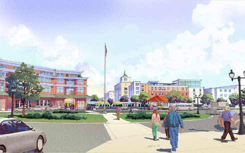
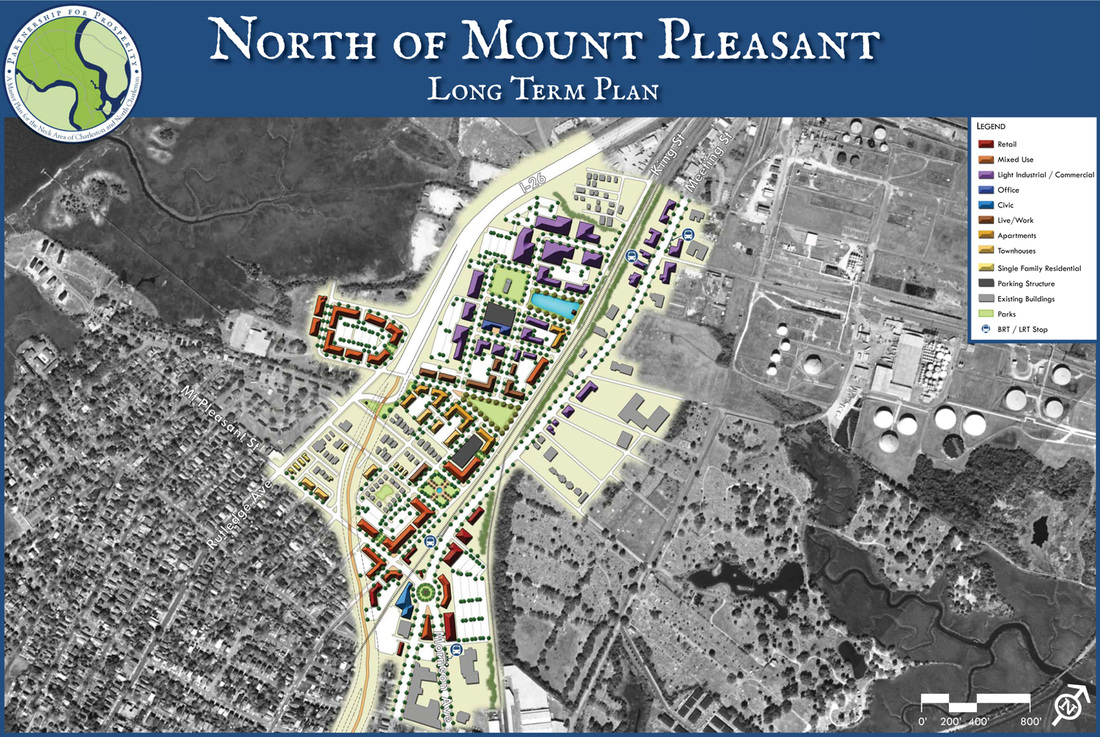
form and development concepts
The center of this catalyst area will be the Meeting/Mount Pleasant intersection; buildings in this area are envisioned as mid-rise (5-7 stories) with higher density uses around a transit core and access points to an extended shared-use path under I-26. This high level of accessibility and connectivity is expected to enhance the prospects for development and spur greater levels of activity in this location. Other areas will be mid-rise (3-5 stories) transitioning down to low-rise (1-3 stories) adjacent to existing uses, especially to the north near open space areas and industrial uses. Another transit stop is planned for Greenleaf Street to enhance accessibility from the north end of the catalyst area to other points along the Neck area’s multimodal spine.
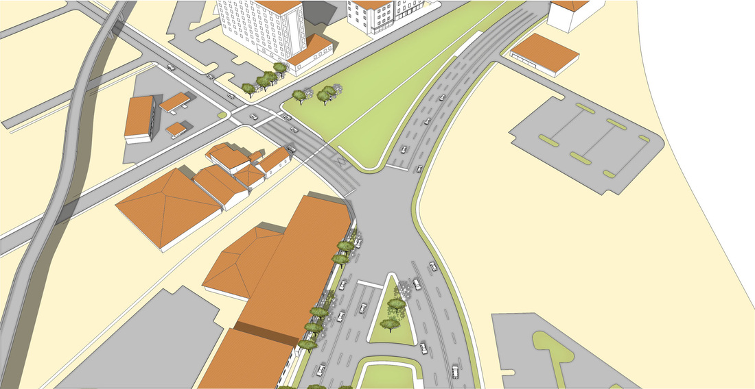
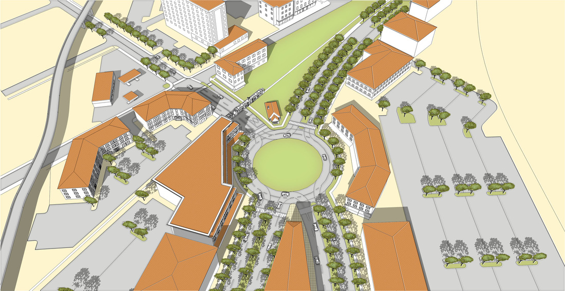
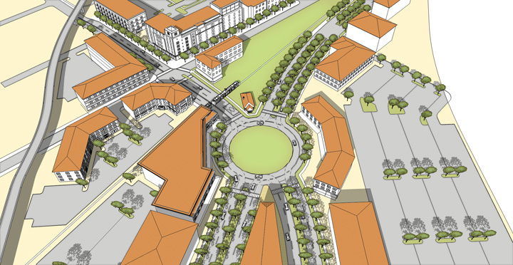
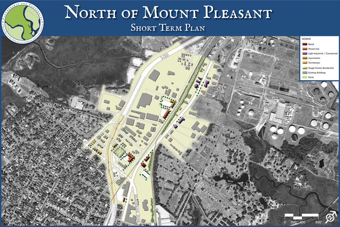
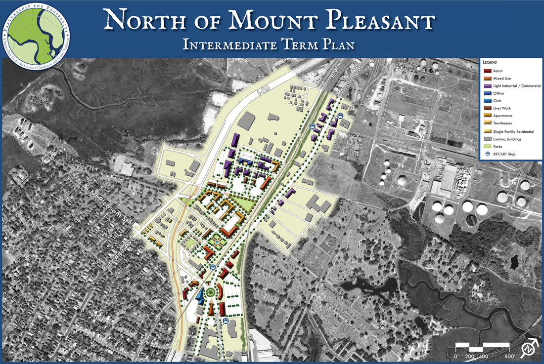
PHASING
The following graphics illustrate the transition of uses and broad-brush phasing within this catalyst area:
|
Short Term Phasing / 1 to 5 Years
|